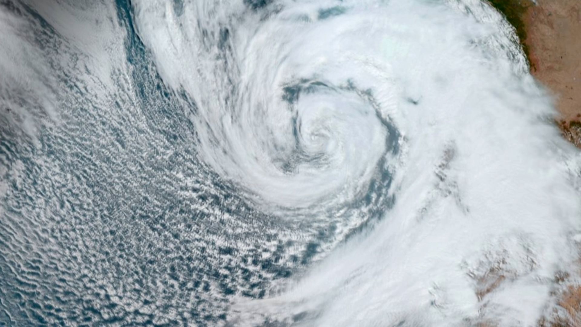
A Pacific cyclone dubbed Polo exploded from a tropical storm into a powerful Category 5 hurricane in less than 24 hours on Tuesday (Sept. 22), with winds reaching speeds of 180 mph (290 km/h). Now drifting off the southwest coast of Mexico, Polo has been downgraded to a Category 4 storm but remains "a very powerful major hurricane," the National Hurricane Center (NHC) said in an update Wednesday (Sept. 23).
As Polo moves northwest, it is expected to drive torrential rainfall on parts of Mexico's southwest coast. Although the storm is not predicted to make direct landfall, the NHC has warned that heavy rain may produce life-threatening flooding and mudslides, as well as extremely hazardous ocean conditions.
Polo is one of the most powerful storms of the Pacific hurricane season so far, which runs from May to November. But what causes a hurricane like Polo to intensify so rapidly? And what role has the "super" El Niño played in the storm's development?
How El Niño contributed
"Rapid intensification of tropical cyclones is something we see several times per year across the globe," Julian Heming, an environmental scientist and researcher at the U.K.'s Met Office, told Live Science in an email. "The main requirements are high sea temperatures, low wind shear and upper air conditions which allow air to escape quickly from the top of the hurricane."
Hurricane Polo intensified rapidly as it moved over exceptionally warm Pacific waters associated with an extremely strong "super'" El Niño that has taken hold off the Pacific since June.
El Niño is a naturally occurring climate pattern that develops in the tropical Pacific Ocean, typically every two to seven years. It begins when waters in the eastern tropical Pacific become unusually warm. The National Oceanic and Atmospheric Administration identifies El Niño conditions when these waters are at least 0.9 degrees Fahrenheit (0.5 degrees Celsius) above average, alongside changes in winds, surface pressure and rainfall that are consistent with the phenomenon.
El Niño events are then classified by strength, ranging from weak to very strong. Although "super El Niño" is not a scientific term, it refers to a very strong El Niño, where the warming of sea surface temperatures is higher than 2C above normal.
The unusually warm ocean supplied Hurricane Polo with abundant heat and moisture, while very moist air and weak winds higher in the atmosphere allowed thunderstorms to organize and strengthen without being disrupted, Hemming said.
Polo also developed a compact, well-defined core, which concentrated the storm's energy into a relatively small area and enabled it to intensify extremely quickly. Together, these conditions created an efficient atmospheric "heat engine" that allowed Polo to strengthen at an exceptional rate.
Related stories- How strong can hurricanes get?
- 'Now is the time': Hurricane category 6 could be introduced under new storm severity scale
- Birth of a hurricane: What meteorologists look for as they hunt for early signs of a tropical cyclone forming
"Polo's rapid and sudden growth is testament to the dominance of this year's so-called super El Niño, which set a record on Monday as the most extreme on record and has amplified a number of extreme weather events globally," Heming said.
The latest data from the World Meteorological Organization suggests that the current El Niño could be the strongest on record and last until at least February 2027. This will lead to more extreme weather, pushing some areas into drought while others experience stronger storms, rainfall and flooding.
If the system moves northward, Southern California could see intense rainfall and coastal regions may experience hazardous rip currents and large swells. However, "There is currently a lot of uncertainty in the long term as to whether Polo will move further out to sea or turn north-eastwards towards Mexico," Heming said.


