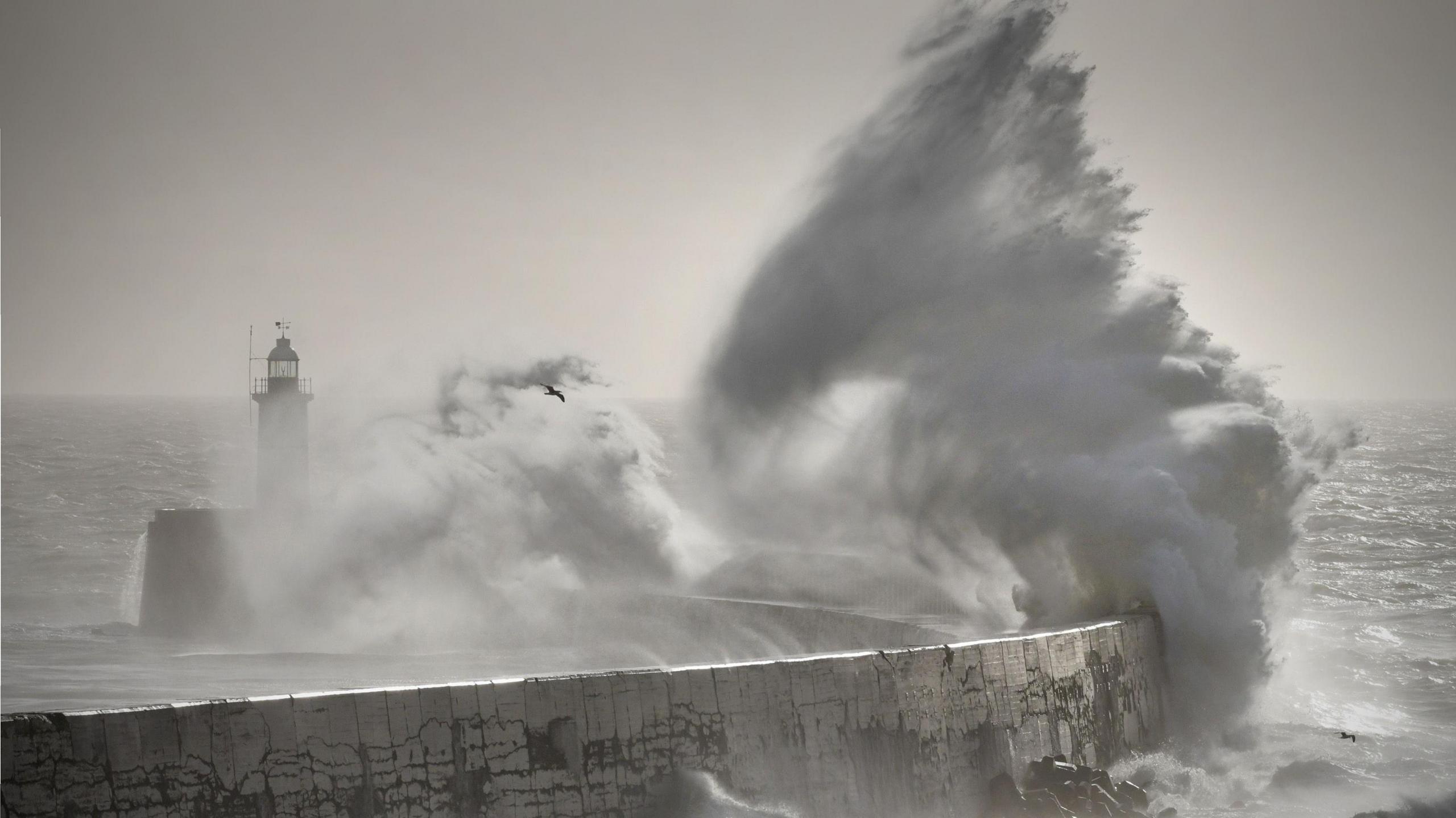
Image caption,
Rough sea along the Dorset coastline on Friday
ByStav DanaosLead Weather Presenter- Published1 hour ago
A second storm in as many days is set to batter parts of the UK, as thousands of homes remain without power following powerful winds and heavy rain on Friday.
Storm Boelo is forecast to hit on Saturday, with an amber weather warning issued from 21:00 BST across much of Scotland as well as parts of Northern Ireland and northern England where gusts of up to 80mph (128km/h) could lash exposed areas.
Travel chaos, power cuts and localised flooding are all possible as the storm sweeps in on Saturday.
The warning comes just one day after Storm Austen unleashed wind gusts in excess of 75mph, resulting in toppled trees, transport disruption and thousands of power outages.
Trains cancelled and roads warnings as Scotland prepares for Storm Boelo
- Published8 hours ago
Storm Austen brings power cuts and travel disruption as more wind and rain forecast
- Published6 hours ago
Strong winds and heavy rain will persist over the weekend as Storm Boelo moves across parts of the country.
An amber weather warning for wind has been issued for across much of Scotland, excluding the Northern Isles, as well as the far north of Northern Ireland and England from 21:00 BST on Saturday to 21:00 BST on Sunday.
Wind gusts of 60-70mph are forecast, with exposed coastal areas potentially seeing speeds of up to 80mph.
The Central Lowlands could also experience periods of disruption as strong winds funnel through the region.
Travel disruption is expected - with ScotRail has confirming that some train services will be cancelled after 21:00 on Saturday - while damage caused by the winds could lead to additional power cuts.
 Image caption,
An amber wind warning for Saturday covers much of Scotland, parts of Northern Ireland and the far north of England.
The second bout of bad weather comes after Austen, the first named storm of the season, brought strong wind gusts to large parts of southern England and Wales throughout Friday. Bad weather disrupted travel with fallen trees blocking railway lines and roads.
In Brighton, part of the iconic West Pier - an abandoned structure that first opened in 1866 - collapsed into the sea.
The National Grid said engineers had restored power to more than 60,000 properties since Storm Austen began - but more than 10,000 homes were still without power on Friday evening.
 Image caption,
Storm Boelo is forecast to bring widespread heavy rain and gales across the UK
Yellow weather warnings for wind on Saturday cover Orkney, the rest of Northern Ireland and northern England.
Gusts of 55-75mph are possible in these areas, with isolated gusts potentially reaching 80mph.
While the worst of Saturday's weather is forecast to be felt in areas covered by warnings, heavy and persistent rain is expected across larger parts of the UK.
Spray and surface water could make driving conditions hazardous, while further downpours increase the risk of localised flooding.
Strong winds are forecast to continue into Sunday, although rain should gradually ease across most of the country.
Sunny spells and blustery showers are expected elsewhere, while north-east Scotland is likely to see the most persistent rainfall.
To play this video you need to enable JavaScript in your browser.
This video can not be played
Figure caption,Watch: Homes without power as Storm Austen batters Britain
Stormy weather to continue early next week
Once the weekend's stormy weather has passed, forecasts suggest another area of low pressure will develop over the Atlantic before deepening as it approaches the UK from the south-west.
This could bring a further spell of wet and potentially very windy weather to much of the country on Monday and into Tuesday.
Whether the system will be strong enough to be named remains uncertain.
Later in the week, high pressure is expected to build over the near continent, bringing a return to drier, calmer and more settled conditions.
Part of Brighton's iconic West Pier collapses
- Published15 hours ago
BBC presenter battles strong winds as Storm Austen hits Newquay
- Published19 hours ago
Are back-to-back storms unusual?
It is not unusual for storms to arrive one after another – in fact, they often develop in clusters, particularly during periods of unsettled weather across the Atlantic.
A strong jet stream is needed to help rapidly develop powerful windstorms. The process involves warmer air being pushed northwards and colder air moving southwards across large areas of the Atlantic, creating a sharp contrast in temperatures.
These temperature differences provide favourable conditions for new low-pressure systems to form and strengthen.
If these systems are then steered beneath a developing, powerful jet stream, they can intensify rapidly, potentially becoming named storms capable of bringing damaging winds, heavy rain and widespread disruption as they move towards the UK.
Stormy autumn, cold winter - how might El Niño affect the UK weather?
- Published3 September
New storm names for 2026-2027 released by Met Office
- Published1 September